Photography by Kathy Tran
It was a clear Monday afternoon — a break from the oftentimes gray and overcast weather Dallas sees in December — as Kelley Hurst drove home, headed northbound on Abrams Road, nearing Forest Meadow Middle School.
Driving onward, a flurry of ambulances, patrol cars and fire engines rushed past. She says she had never seen “such a response,” and that her son had heard a loud crash a street or two away. So, after parking at her house nearby, she walked down the street to investigate and turned on Abrams, facing toward the school.
“I was speechless,” Hurst says. “I mean, the two parts of the car were so far apart. I can’t even really imagine what had happened.”
In the middle of a median, wrapped around a small tree, the shattered front half of a McLaren 570S showed no signs of movement from the passenger cabin. Dallas Police got a call to respond at approximately 3:10 p.m. The rear portion of the vehicle, completely detached, could be found further away. Another vehicle, a Toyota Corolla driven by a 44-year-old woman listed on the Texas Department of Transportation crash report as a “possible injury,” was also involved in the crash and sustained heavy front-end damage.
“She was facing east away from me, but I just saw her sitting there, and emergency personnel were checking her out, and then she was gone,” Hurst says. “Most of the emergency vehicles left, because there was an ambulance and a fire truck, and there wasn’t anybody else to save.”
The investigation into the cause of the crash is still ongoing.
The crash took place in a school zone for the Forest Meadow Middle School, where traffic was blocked by the Dallas Police Department on Abrams Road. pic.twitter.com/7Ubngu8CwN
— News News News (@NewsNew97351204) December 10, 2024
There wasn’t.
“I’m seeing the group text messages lighting up that something horrible had happened, apparently one mother’s child saw the deceased gentleman hanging out of his car,” resident Megan DuBose says.
According to the Texas Department of Transportation crash report obtained by the Advocate, the driver, 29-year-old Cristobal Flores Espino, and his passenger, 31-year-old Robert Rocha, showed no signs of life when Dallas Fire-Rescue arrived at the scene.
A luxury car had been totaled, a woman left shaken up, and two young lives snuffed out.
All near an active school zone designated for Forest Meadow Middle School, which would release its students from class no later than a half-hour later. Parent GroupMe chats and Facebook groups swirled with shock, confusion, concern, but above all, outrage as rumors circulated of 100 mph plus speeds. At a March community meeting, DPD officers estimated the actual speed to be closer to 50-60 mph in a stretch of Abrams with a 40 mph speed limit.
“No one wants to see people who are speeding lose their lives, but that was an example of what could have happened to a bunch of kids,” neighbor Jenny King says. “Had it happened 30 minutes later, we shudder to think of the results then.”
According to the TxDOT report, the crash happened after the McLaren coupé hit a since-mended bump in the road. The driver began to lose control of the car, bumping the second vehicle into a tree before spinning out and crashing into another tree, where he and Rocha died.
King has lived in the neighborhood for 20 years and says she has seen traffic safety, especially speeding, trend in an increasingly worrisome direction on Abrams and Lake Highlands in general.
“I guess we all kind of thought, and I thought, ‘Well, I’m not surprised, really, not surprised at all,’” King says.
Abrams
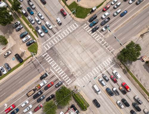
Abrams Road stretches a little over 8 straightline miles within City of Dallas limits, running south to north from Old East Dallas to Walnut Street at the border with Richardson. Relatively a straightforward path compared to other winding roads in the area, such as Walnut Hill, Abrams is a three-lane arterial road that slims down to two lanes below Mockingbird Lane.
According to TxDOT data obtained from the agency’s Crash Records Information System (CRIS), from 2015 to 2024, there were 2,075 crashes on Abrams within the City of Dallas limits, with 419 speed-related (7.683 speed-related per lane mile). Compared to Walnut Hill Lane, which recorded 2,154 crashes with 511 speed-related (6.17 per lane mile) in that period, or Royal Lane, which recorded 2,298 crashes with 528 related to speed (6.686 speed-related per lane mile), it might not seem like much of a problem.
However, Abrams is slightly more hazardous. From 2015-2024, there were 12 fatal crashes on the road, five of which were speed-related. That’s compared to Royal, which recorded eight fatal crashes with four related to speed, and Walnut Hill, which recorded eight fatal crashes with two related to speed in that time.
On Greenville Avenue, which has a higher speed-related crash frequency (9.143 per lane mile), six fatal crashes were reported, with two of those speed-related. Even on Preston Road, a three-lane state highway with a speed-related crash frequency close to twice that of Abrams (12.61 per lane mile), only seven fatal crashes were reported, with two speed-related.

Photography by Kathy Tran
Of the eight arterials we collected data on, the roadway with the largest proportion of fatal incidents in speed-related crashes was found on Abrams Road (1.19%).
Some neighbors attribute the issue to the wide and straightforward design of the road, while others insist exit closures tied to the I-635 East Project have caused drivers to treat the road as an alternate thoroughfare. Data obtained by the Advocate does not show a marked increase in speed-related crashes, crashes involving suspected severe injury or overall crashes on Abrams north of Northwest Highway from 2015-19 to 2020, when the project began, through 2024. There was, however, an increase (two from 2014-2019, five from 2020-2024) in fatal crashes.
“I think there are speeders that we didn’t have in the volume, it seems today versus 10 years ago. Any night in Lake Highlands or all over Dallas, you can hear those loud cars that you know are speeding,” King says.
Citywide
The crash in December understandably fanned residents’ fears over traffic safety on Abrams Road — a McLaren wrapped around a tree near a school crosswalk at 3:15 in the afternoon is a powerful image for parents.
But while Abrams may show a relatively higher frequency of speed-related deaths, elsewhere in Lake Highlands and Dallas, things tend to get worse.
Residents often joke about Dallas drivers, and the national media seems to agree, with Forbes Advisor placing Dallas at sixth on its list of U.S. cities with the worst drivers. Dallasites know their fellow drivers as distracted at best and downright malicious at their worst. The numbers seem to back that idea up.
Data obtained by the city’s Department of Transportation shows Dallas had the second-highest rate of traffic fatalities from 2015 to 2019 among the top 15 most populous cities in the U.S., with 14.11 fatalities per 100,000 residents. In a report from 2022, data from the National Highway Safety Administration (NHTSA) shows Dallas as having maintained its position as the second-deadliest major U.S. city through COVID, with Dallas’ increased rate of 17.54 traffic fatalities per 100,000 residents beat out only by Phoenix.
Furthermore, data obtained from the Texas Department of Transportation shows Dallas had the highest number of speed-related fatal crashes per 100,000 population of major Texas cities, with 5.7 speed-related fatal crashes per 100,000 residents (San Antonio comes in second with 3.6 per 100,000). Speeding was the leading contributing factor in severe and fatal crashes in Dallas from 2015 to 2019, according to data from the city’s transportation department.
To combat the underlying issue, the City of Dallas adopted a resolution creating the Vision Zero Plan in 2019, with an action plan approved by city council in 2022. The plan is inspired by a wider international effort led by the Vision Zero Network to reshape cities’ approach to traffic safety and completely eliminate traffic fatalities. The aim of the plan in Dallas is to achieve the ambitious goal and cut the number of severe injury crashes in half by 2030.
Dallas’ Vision Zero plan revolves around using data to pinpoint hazardous roadways. To do this, the plan prioritizes traffic and corridor studies to evaluate problem areas. Then, it sets out a structure for collaboration between local, state and federal agencies, enforcement, increased education and streamlined transportation department projects like traffic light additions designed to deliver results.
Engineering-forward solutions are needed in Dallas, where most roadways were designed and built in the mid to late 20th century, as is often the case in Sun Belt cities across the southern U.S. Of the 15 most populous cities in the U.S., the top five cities with the highest rates of traffic fatalities in 2022 (Phoenix, Dallas, Jacksonville, Houston and San Antonio) were all found within the Sun Belt, according to NHTSA data.
At a city council briefing on Vision Zero from April 3, 2024, Dallas Department of Transportation Director Ghassan Khankarli referred to a 2024 New York Times podcast on pedestrian fatalities in the U.S., which detailed higher rates of traffic fatalities and the impact of road design in Sun Belt cities.
“Think about it as the Loop 12s of the world, the Military Parkways of the world,” Khankarli said at the briefing. “The development of the Sun Belt, parts of the county of which Dallas is in, coincided with the auto age and all the standards that governed, or the guidelines that govern the design of those roadways. Every roadway was to be designed like a freeway.”
On Loop 12, which has been dubbed “Dallas’ Deadliest Road,” there were 22,618 crashes reported from 2015 to 2024, with 6,532 reported as speed-related on the loop. Of those, 755 crashes (221 speed-related) were reported as involving a suspected serious injury. In addition, 202 fatal accidents were reported on Loop 12 in that span (Abrams had 12), with 80 of them speed-related.
High-crash frequency portions of Loop 12 can typically be found in South Dallas on roads such as South Buckner Boulevard, Great Trinity Forest Way and Ledbetter Drive. At a news conference held last December, Interim Dallas Police Chief Michael Igo said there were 16 fatalities on an 8.6-mile stretch of Loop 12 in Southern Dallas in 2024.
Closer to Lake Highlands, Forest Lane, which runs 69.2 lane miles within the city of Dallas, had a substantially higher number of overall crashes than Abrams (3815), speed-related crashes (855) and fatal crashes (22, with eight speed-related) from 2015 to 2024. Pedestrian injuries must also be factored on Forest, which has been identified as a pedestrian high injury network by Dallas’ transportation department. (Eight pedestrian fatalities have occured in the last four years on Forest, according to DDOT.)
Skillman Street also appears to be more hazardous, with 2,590 crashes reported over nine years, and 637 of those speed-related ( approximately 13.034 per lane mile). North of Northwest Highway, Skillman recorded more crashes involving fatalities (eight compared to seven fatal crashes on Abrams north of Northwest Highway), crashes with suspected severe injury (58 to 35 on Abrams) and crashes related to speeding (479 to 225).
Since adopting the Vision Zero action plan, Dallas has recorded three straight years of decreases in speed-related and severe crashes. However, of the four most populous cities in Texas, Dallas’ plan is the only one not recognized by the Vision Zero Network.
As part of the plan, the city identifies high-injury networks (HIN), defined as “the 7% of roads that account for 62% of severe crashes.” In Lake Highlands, Forest Lane, Audelia Road, Park Lane/Church Road and Royal Lane are identified as HIN.
Abrams is not.

Photography by Kathy Tran
So, why does Abrams matter?
“What I’m telling you (is), there are a lot of areas in this city that have high fatality rates because of speed,” DPD Sgt. Ira Carter told neighbors at a March 19 community meeting. “You’re not there yet. You’re not there yet, and we pray you don’t.”
“If that car had gone the other way, it would have hit my backyard with my kids playing in it at the time,” a neighbor added later on in the meeting, her voice shaking with emotion.
That seems to encapsulate what most neighbors feel is so important about traffic safety on Abrams. With residential neighborhoods abounding and four Richardson ISD schools’ boundaries straddling the road within a 2-mile stretch of Abrams, residents have expressed concern for their children’s safety.
“I don’t let my daughter walk home from school, even though our house is close enough that it should be fine because she would have to cross Abrams,” says 12-year resident Nicole Ellery.
The importance of traffic safety near schools on Abrams was underscored less than two weeks after the first crash when, on Dec. 18, another multi-vehicle collision occurred during afternoon school hours, leaving one car on the lawn of Forest Meadow Middle School.
“Eighth grade has athletics the last period of the day,” Ellery says. “They had been congregating right there in that same spot just the week before, at that same exact time.”
Resident outcry had already been building from the previous wreck at that point, with a change.org petition calling for increased traffic safety in Lake Highlands amassing more than 500 signatures within several days.
The petition states: “Our children’s safety is paramount, and unfortunately, due to the number of wrecks occurring near (and sometimes in) our yards, there is legitimate danger for children not only walking to and from school, but also for those being driven by parents and caregivers.” It was started by Megan DuBose, whose children attend Skyview Elementary.
“This was the type of thing where I’m not sleeping, I’m getting so frustrated, I’m hearing everybody be like, ‘What can we do about this? What can we do?’ And I was like, look, ‘At least I’m decent at writing, so I’ll write down something,’” DuBose says.
As a result of the crash and DuBose and other neighbors’ outcry, District 10 council member Kathy Stewart worked with the city’s transportation department to commission a traffic study to assess problem areas on Abrams Road from Meadowknoll Road to Royal Lane. The study launched in January of this year and had an initial completion timeline of four to six months.
DuBose says while she appreciates Stewart’s response to the issue, she and other neighbors would like to see tangible changes enacted without the hurdles of a protracted traffic study.
“You could hear some of them were just, downright pissed,” DuBose says. “And they cited specific changes that have been happening. Someone was like, ‘I don’t understand why this light needs to get replaced on Greenville when it had just been replaced a couple years ago.’ I think it’s frustrating, especially for those of us that aren’t steeped in all things local city government.”
Stewart told the Advocate in March that she understood the frustration.
“It will test your patience, and I am learning that it’s just the bureaucracy of city government, but I believe that it happens at the state and federal levels as well. But when you’re dealing with government entities, there’s just a lot of process that has to be honored, and that just takes time. And for that, I apologize.”
DuBose also says she felt representatives from the transportation department and DPD’s traffic unit came off defensive in the March 19 community meeting.
“I think people felt defensiveness in the room about some of the things from DPD and the engineering that, like, we didn’t understand the defensiveness, right?” DuBose says. “We’re just coming from a place of, ‘We’re worried, we don’t really know how city government works, but we would be happy to share what we’ve observed and hear some of your thoughts.’”
At the meeting, DPD’s tactical operations division commander told residents, “There was no alcohol involved, it was an accident,” of the December crash.
According to the crash report obtained by the Advocate, Espino, whose obituary describes him as an avid racing fan, had a .274 BAC at the time of the wreck and tested positive for cocaethylene, ecgonine methyl ester and benzoylecgonine. Intoxication from both drugs and alcohol were listed as contributing factors alongside speeding in the crash report.
Representatives from DPD said in an email the statement was made based upon information known at the time. The crash report shows a final supplementation from March 7, more than a week before the meeting.
What’s next?
At the meeting, multiple neighbors expressed concerns over areas outside of the original study’s scope. To respond to these concerns, Stewart told the Advocate that the length of Abrams covered in the study has been expanded to include intersections like the one found at Church Road/Park Lane. She says that due to the expansion, the timeline for the project is unclear.
Richardson ISD officials told the Advocate that the district is paying for an improved pedestrian crossing with an updated sidewalk and traffic signals at the northwest corner and the southwest corner of the Abrams-Whitehurst intersection. The project is expected to be completed in time for the school year. In addition, the City of Dallas, Stewart and the district have agreed to split funding for crossing guards at Forest Meadow Middle School and Lake Highlands Middle School for the 2025-26 school year.
According to the Vision Zero Dashboard, while Dallas has recorded three straight years of decreases in overall crashes, speed-related and severe crashes since implementing the action plan, fatal accidents have failed to show similar progress, despite modest decreases. In 2022, Dallas recorded 218 fatal accidents, which fell to 201 in 2023. In 2024, 208 fatal accidents occured in Dallas. All three years show an increase from 2015-2019, when the city averaged 178 fatal crashes annually.
Progress can’t come soon enough for residents like Nicole Ellery, who says the situation on Abrams has led her to consider a major life change.
“This has been stressful enough that this is the first time that we have seriously been looking to move out of Dallas, and I’ve owned this house for a long time. I bought it at the bottom of the market, so sitting good, and I think it’s a great location, and I love Lake Highlands, but it’s just so stressful.”

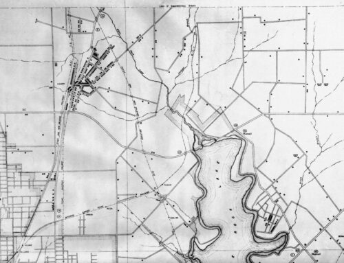
*Most data in this story was obtained from TxDOT’s Crash Records Information System (CRIS). To obtain the data, we set a range from the years 2015-2024 and specified a crash location of the City of Dallas within Dallas County. After inputting each specific road, such as Abrams, we pulled the data straight from TxDOT’s results. All CRIS data is accurate as of May 14. To determine crash numbers in Lake Highlands, we used CRIS’s map selection tool (photos of our selected road portions can be found in the online version of this article). While they should be considered mostly accurate, differences in selected map points may result in slight statistical variations. Road lengths, and by extension, crash frequencies, were determined by cross-referencing Advocate-obtained data with lane mile road lengths provided by the Dallas Department of Transportation and Public Works. All other data in this story was obtained from Dallas City Council Briefings, The Dallas Department of Transportation and Public Works, Dallas’ Vision Zero Dashboard and other government agencies.