Trails in White Rock and surrounding areas
On the surface, the whole three-phase Katy Trail Extension, part of the larger SoPAC trail projects, is a tangled web. This is about the three separate trails that eventually will connect somewhere near the Ridgewood Belcher Recreation Center, just northwest of White Rock Lake, forming one long path that extends about eight miles from American Airlines Center to White Rock Lake — they are identified as two total projects managed and maintained by two different entities, the City of Dallas Public Works Department and the Dallas County Public Works Department, respectively.
Portions of segments of these trails, are already useable.
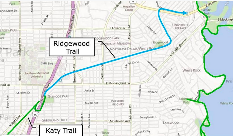
Some parts, such as the Ridgewood Trail that runs beneath the Fischer bridge just north of Mockingbird to Skillman north of Abrams, make for more than a mile of shaded, smooth running and offer an encouraging preview of things to come. Other swaths, such as the just-under two-mile stretch from Fisher to White Rock Lake, while unfinished, make for a fun, rugged, unpaved dirt-trail hike. I met a lady walking her dog there last week who said she’d prefer it remain unpaved. I too enjoy the dirt.
According to the SoPAC master plan, “the area south of the Mockingbird overpass between Santa Barbara Drive and Fisher Road is a good location for a trail connection to the adjacent communities while still allowing easy pedestrian and cycle access to the corridor.”
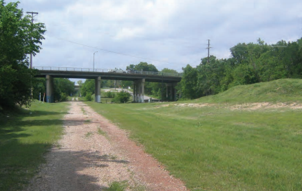
Unpaved trail under Fischer
And another portion, the part that starts behind the “Katy Trail Extension” sign on Trammel and points west with a wide, concrete path flanked by a playground/sprayground — but only continues for half a mile before ending abruptly at a wall of towering weeds.
It was after staring into the wall of frenzied flora that I decided to attempt to untangle this web. Turns out it’s not all that confusing, I guess. Senior information officer Justin Lewis Snasel at Dallas City Hall was helpful enough to gather all the information available about the under-construction trail system:
The City of Dallas’ Public Works Department is managing the Katy Trail Extension Project, phases III, IV, and VI. Phase III, the Ridgewood Trail in East Dallas from McCommas to Glenco Park, is complete.
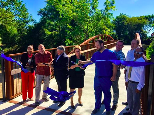
Phase III ribbon cutting ceremony : Friends of the SoPac Trail
Phase IV includes three trail segments with three names, but they are all one connected swath. 1) Ridgewood Trail from Skillman to the Ridgewood Belcher Recreation Center on Trammel 2) the SOPAC Trail from the Ridgewood Belcher Recreation Center to Northwest Highway 3) Flag Pole Hill Trail in Lake Highlands from Northwest Highway to the DART White Rock Station. Altogether this covers about two and a half miles and features four pedestrian bridges. Two of said bridges are complete and two will be built by this fall.
Phase VI is the construction of the Ridgewood Trail from Ellsworth to Worcola. It includes two pedestrian bridges that require right-of-way acquisition from owners around Mockingbird Station.
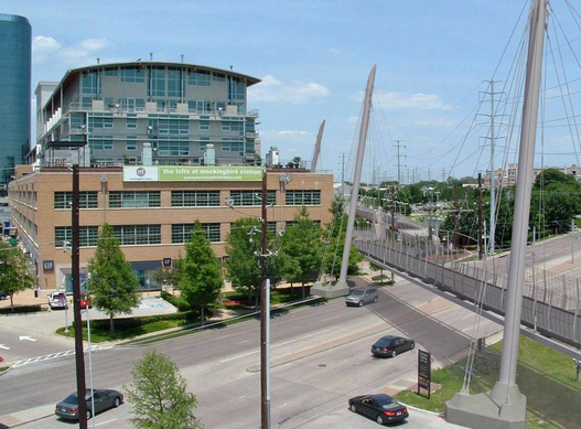
Mockingbird-Katy Trail bridge rendering
Construction of the SOPAC Trail from the Ridgewood Belcher Recreation Center to White Rock Lake is managed by Dallas County’s Public Works Department. This part is called SOPAC Trail Phase 3 (we wrote about the Gaston connection here), and construction should begin late summer 2015 and wrap up in fall 2016.
Here is how it will all eventually connect from Katy Trail to White Rock DART/Flag Pole Hill, courtesy Dallas Hike & Bike group. “Heading north on the Katy Trail you will cross Central using the McCommas Bridge. When TxDOT rebuilt Central, the McCommas bridge was built extra wide to accommodate the trail on the bridge’s north side. From there you will follow the trail along the frontage road and into Glencoe Park. North of Glencoe you will use the bridge to cross Mockingbird and access Mockingbird Station. Then the trail turns to the north east, following the DART Blue Line to the White Rock Station. Just an FYI but the trail changes names to the Ridgewood Trail once it crosses Central.”
Courtesy City of Dallas Hike & Bike Trails Facebook page
Upon completion, Dallas parks and Recreation will manage and maintain all trails.
The $17 million project is covered mostly by city bond money. Dallas County will chip in $1 million and the Regional Toll Revenue fund will pay $6.48 million.
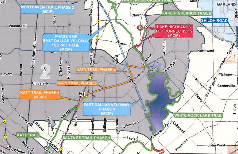
Greater map of Dallas county trails
SoPAC’s master plan includes extensions through the Vickery Meadow, Fair Oaks and northern areas of Lake Highlands, which is another story for the future.
Way back in 2009 we did an overview of area trails. Much of this is still pertinent. As I write, I’m thinking we need to produce an updated version.