(Image courtesy of the Texas Water Development Board)
With multiple sailing clubs, expanding rowing groups and paddle board enthusiasts populating White Rock Lake, neighbors might wonder exactly how much water they are sitting on.
In 2014, the Texas Water Development Board and the Army Corps of Engineers partnered to do a study of our neighborhood lake to see how the sediment that pours into the lake is affecting its depth. With multiple creeks flowing into the body of water from all angles, sediment has surely made things even shallower in the four years since this study was commissioned.
Using something called a multi-frequency sub-bottom profiling depth sounder, they analyzed the lake’s depth and sediment thickness.
The study found that the lake contains 10,230 acre-feet (an acre foot is one foot of water that covers an acre) of water, which is down from the original volume of over 18,000 acre feet. It also found 3,550 acre-feet of sediment accumulation.
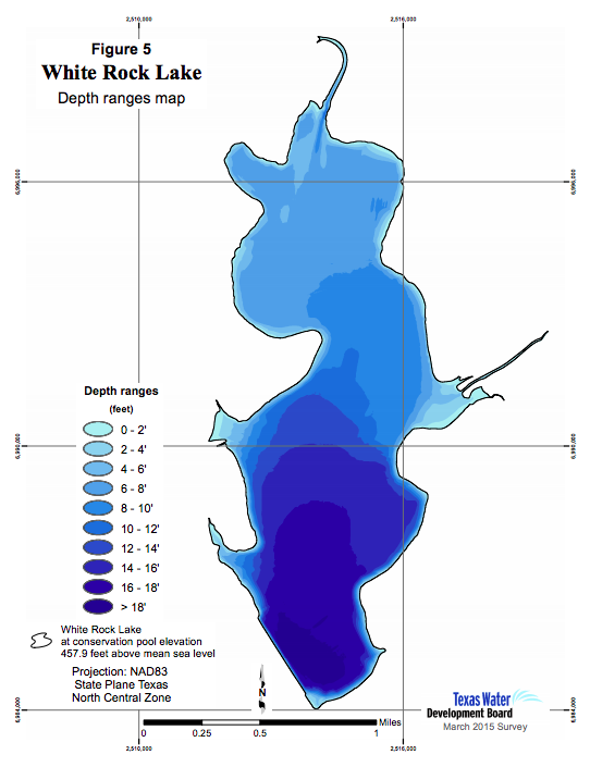
According to the Texas Water Development Board, the lake’s depth ranges from over 18 feet near the dam to the south end to large swaths of less than two feet of depth in large sections where White Rock Creek and Dixon Branch dump into the lake. A good portion of the south end of the lake is over 10 feet deep, while most of the north half of the lake is under 6 feet deep.
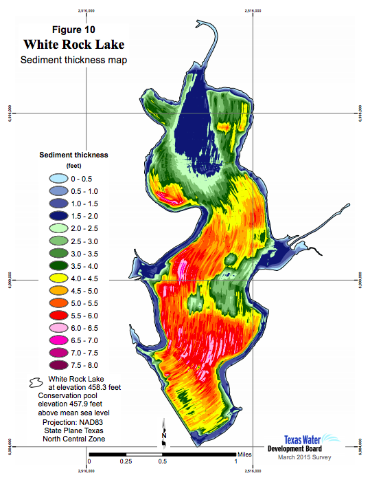
The study also mapped the thickness of the sediment, which was 6 to 7 feet thick in some places throughout the lake. The southern and western portions of the lake had the most sediment. See below for a map of the sediment.
If you want to read the entire study and see other maps about the lake, see the full report here.
(Image courtesy of the Texas Water Development Board)